Location and Landscape
Great Torrington stands on a prominent ridge in North Devon, rising sharply above the winding course of the River Torridge. The town's elevated position — the ridge reaches some 200 metres above sea level — gives it commanding views across the surrounding countryside and made it a natural defensive site long before the Civil War.
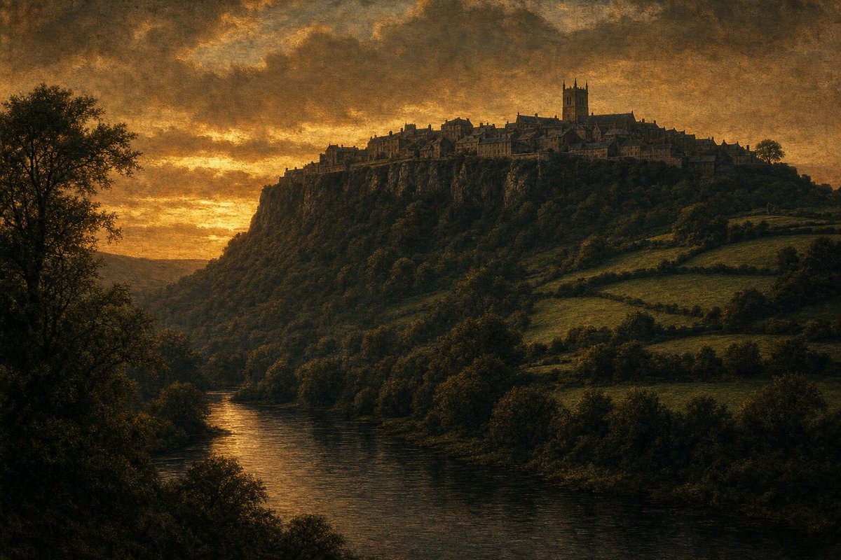
The town lies at the heart of a deeply rural part of Devon, a landscape of wooded valleys, hedgerow-edged fields, and scattered farmsteads that has changed relatively little in character since the seventeenth century. The Torridge valley below the town forms part of the route now followed by the Tarka Trail, a long-distance path inspired by Henry Williamson's novel Tarka the Otter, set in this landscape.
Medieval Origins
Torrington's origins as a settled place predate the Norman Conquest, but it was the Normans who gave the town its medieval character. A motte-and-bailey castle was established at the north end of the ridge shortly after 1066. The Castle Hill earthworks — the remains of the mound on which the Norman keep once stood — are still visible today.
The town received its market charter in the medieval period and became an important trading centre for North Devon. Glove-making emerged as a significant local industry, and Torrington's leather and textile trades gave it economic significance beyond its modest size. By the Tudor period, it was one of the principal towns of North Devon.
Torrington in the Civil War
The outbreak of the Civil War in 1642 placed Torrington in a strategically important position. Its hilltop location, controlling routes through the Torridge valley and into North Devon, made it valuable to both sides. The town changed hands more than once during the early years of the conflict.
By February 1646, Lord Hopton had concentrated the remnants of the western Royalist army in and around Torrington. The town's elevated ridge provided a strong defensive position, with steep slopes on three sides. The narrow streets and stone buildings offered further protection to defenders. Hopton prepared his men for a stand against Fairfax's approaching New Model Army.
The battle that followed on the night of 16 February was one of the most dramatic of the entire Civil War. When the powder store in St Michael's Church exploded, it destroyed the church and killed hundreds of men. The explosion ended the battle and effectively ended Royalist resistance in the South West.
The Town After 1646
The aftermath of the battle left Torrington in a difficult state. St Michael's Church had been destroyed, a significant number of the town's inhabitants had been caught up in the fighting, and the disruption of trade and agriculture during years of conflict had taken an economic toll. Recovery was gradual.
The church was rebuilt in the years following the Civil War, and the town slowly returned to its agricultural and trading rhythms. The glove-making industry continued to provide employment into the nineteenth century. Today, Great Torrington is a quiet market town whose Tuesday market has operated for centuries.
Frequently Asked Questions
Where is Great Torrington?
Great Torrington is a small market town in North Devon, England, situated on a high ridge above the River Torridge. It lies approximately 8 miles south of Bideford and 20 miles west of South Molton. The nearest large city is Exeter, about 35 miles to the south-east.
↑ Read more: Location and Landscape
Why is Torrington called "Great" Torrington?
The "Great" distinguishes it from the nearby villages of Little Torrington and Black Torrington. The prefix dates from the medieval period, when Great Torrington was the most significant of the three settlements — a market town with a castle and borough status.
↑ Read more: Medieval Origins
What is Great Torrington known for historically?
Great Torrington is best known for the Battle of Torrington in 1646, the last major engagement of the First English Civil War in the South West. The town also has a Norman castle mound, a medieval church (rebuilt after the 1646 explosion), and a history as a centre of the North Devon glove-making trade.
↑ Read more: Torrington in the Civil War
Did Torrington have a castle?
Yes. A Norman motte-and-bailey castle was built at Torrington shortly after the Conquest. By the Civil War period the castle itself had long fallen out of use, but its earthworks — the Castle Hill — still dominate the north end of the town and provided a natural defensive position in 1646.
↑ Read more: Medieval Origins
What happened to St Michael's Church after the 1646 explosion?
St Michael's Church, which had been used as a Royalist powder magazine and was destroyed in the explosion of February 1646, was subsequently rebuilt. The present church building incorporates later construction from the post-Civil War period. It remains the parish church of Great Torrington. For a full account of the explosion, see the Battle of Torrington.
↑ Read more: The Town After 1646
Is Great Torrington worth visiting?
Great Torrington is a pleasant North Devon market town with panoramic views over the Torridge valley. Points of interest include the Castle Hill earthworks, St Michael's Church, the town square, and the surrounding countryside. The Tarka Trail — a long-distance cycling and walking route — passes nearby. The town's Civil War history is explored in detail on our Battle of Torrington page.
↑ Read more: Location and Landscape
What county is Great Torrington in?
Great Torrington is in Devon, in the South West of England. It is part of the Torridge district of Devon and sits within the North Devon Area of Outstanding Natural Beauty. For the county's wider Civil War history, see The English Civil War in Devon.
What is the Tarka Trail and does it pass through Torrington?
The Tarka Trail is a long-distance cycling and walking route through North Devon, named after Henry Williamson's novel Tarka the Otter, set in the Torridge and Taw valleys. The trail follows the old railway line through the Torridge valley below Great Torrington, making the town a popular stop for cyclists and walkers exploring the area.
↑ Read more: Location and Landscape